3D Terrain & Contour Map
Overview
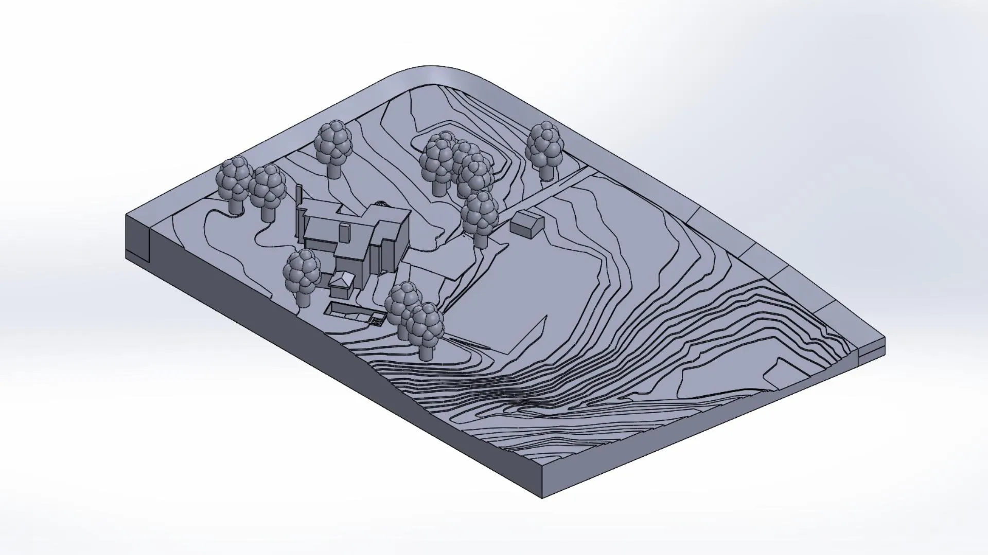
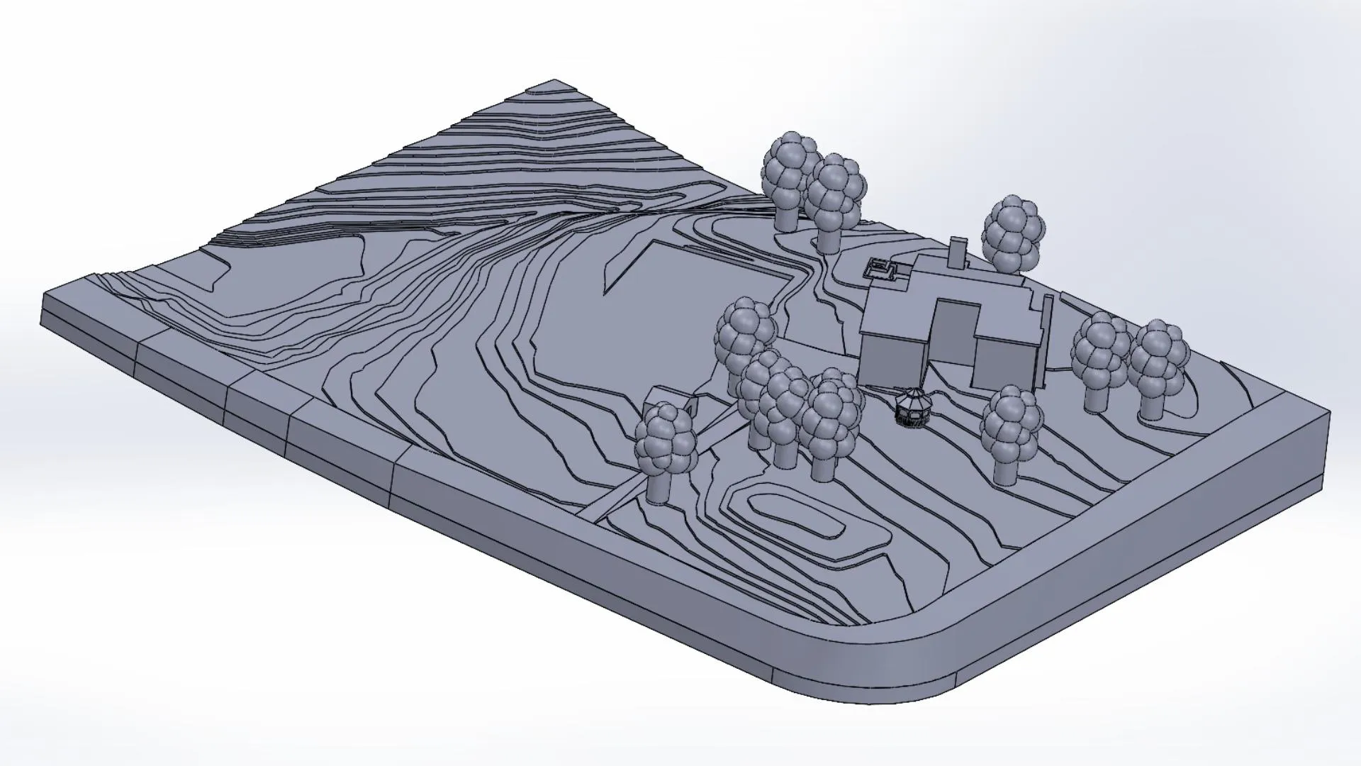
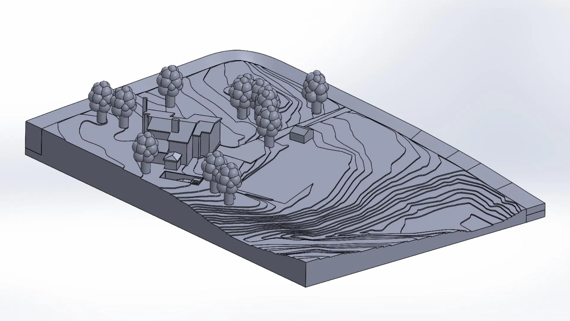
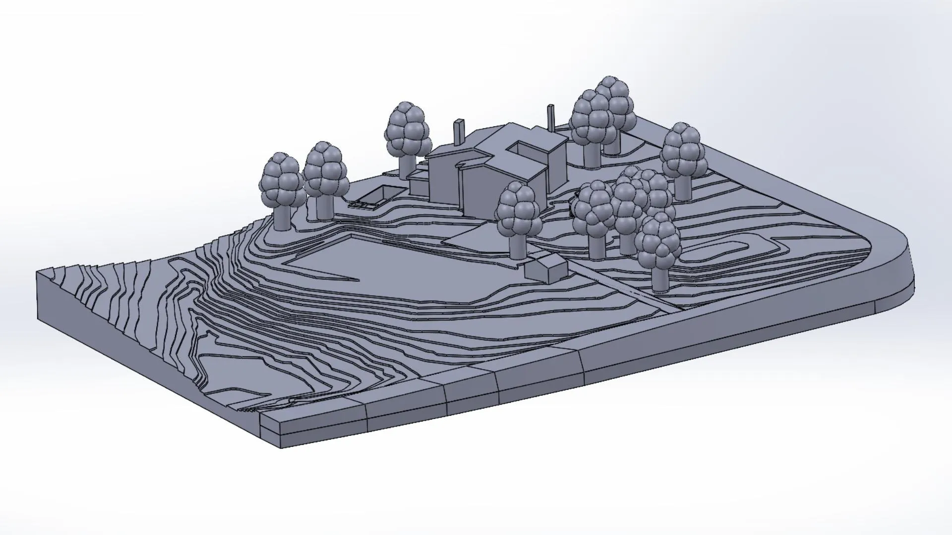
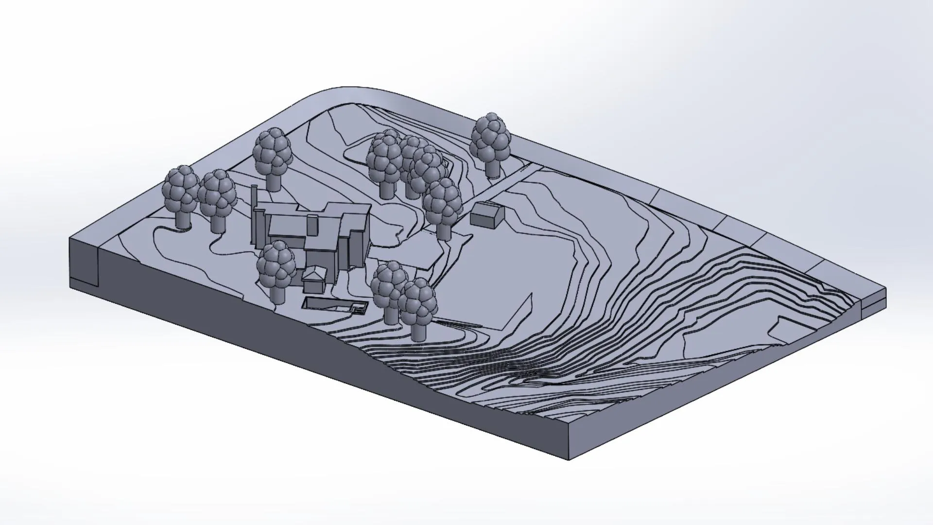
Real-world scaled 3D CAD model of a client’s property developed from map-based elevation data and satellite imagery, accurately representing terrain, contours, and structural elements.
Specifications
- Input: Map file with elevation data + satellite images
- Scaling: 1:1 real-world scaling
- Scope: Terrain, contours, and property elements
- Output: Full 3D CAD model
Design Constraints
- Accurately translate elevation data into 3D geometry
- Maintain real-world scale and proportional accuracy
- Integrate terrain features with property structures
- Ensure smooth contour transitions without geometric distortion
⭐⭐⭐⭐⭐
One of the best experiences I've had on Upwork, really great job creating 3D landscape and architectural model for printing.Paris Lovett
Client
Design Approach
Elevation data from the provided map file was used to generate contour-based terrain geometry, which was then refined into a continuous 3D surface.
Satellite imagery was referenced to accurately position buildings, trees, and property features, ensuring spatial consistency with the real-world layout.
Key Features
- Accurate terrain modeling based on real elevation data
- Full property representation including structures and vegetation
- Clean contour integration with smooth surface transitions
- Dimensionally consistent real-world scaling
Deliverables
- Complete 3D CAD model of the property
- Accurately scaled terrain and contour representation
- Integrated structures and landscape elements
- Client-ready model for visualization and further use
Outcome
Delivered a fully scaled and spatially accurate 3D model of the client’s property, effectively translating real-world terrain data into a usable CAD representation.
Project information
- CategoryClient Project
- ClientParis Lovett
- Project dateOctober, 2025
- View Project on Upwork